Last roadtrip stop for The Drive: Gaithersburg Book Festival May 19th
I’ve downloaded more than my share of handy travel apps and relied on Siri to talk me to hotels after nighttime car rentals at unfamiliar airports. But for long distance road trips my advice is to unplug.
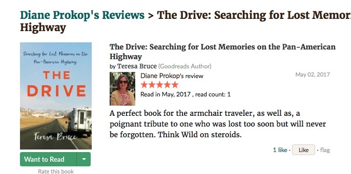
I did — for almost 20,000 miles. With no GPS, WiFi or backup plan, my drive along the loosely-connected, language-spanning, under-maintained, trans-continental Pan American Highway should have been a disaster. Instead, it turned into a life-changing adventure and reason the Gaithersburg Book Festival picked “The Drive: Searching for Lost Memories on the Pan-American Highway.”
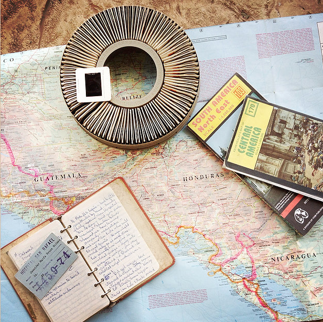
In the single-wide Oregon trailer house where I grew up, maps weren’t for finding treasure. They were the treasure. My father was a long-distance truck driver and a sailor before that. He used maps as wall paper: highlighter-traced and flag-pinned evidence of our family’s nomadic history. Our bookcase stacks of Rand McNally’s and AAA trip tix were as high as our piles of National Geographic magazines: alphabetized and ruler-folded to their original, crisp creases.
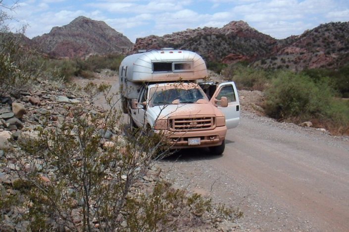
Even so, when my husband and I set out in 2003 to drive a vintage truck camper to the end of the Pan-American Highway in Tierra Del Fuego, Argentina I thought we needed technology. I bought the fanciest after-market Garmin and loaded it up with software claiming we would never get lost: from Mexico through Argentina.
But a funny thing happened on the way to the Mexican border in Nogales, Arizona. I realized road trips aren’t about the shortest distance between two points. It’s the journey that matters and nothing is better company than a map.
Screens are instructions where maps are invitations. So I pulled out a rubber-banded stack of maps my father saved from driving this exact route thirty years earlier, when I was a little girl of seven. I smelled the stains of spilled coffee and smiled at the pink, highlighted highways. Wider and wider I opened the faded maps, skipping countries ahead and traveling back in time. The names of towns jumped out in double-Dutch rhymes: Huehuetenango, way-way-to-go and Solala, so-long-ago. No computer-generated voice told me to make a U-turn or recalculate; technology was no longer my task master.
Maps provide a physical sense of direction, time and place that screens can’t. Pinching and stretching pixels isn’t the same as tracing a route with your fingers. When you touch a crinkled map your finger instantly becomes a scale by which to judge distance and estimate time – you measure and calculate the consequences of a detour or whether you’ll arrive in time to catch the sunset.

There’s an art to folding a map but it’s the unfolding that expands horizons. You discover where roads originate and lead. Far-away destinations listed on highway exits suddenly make sense. Beltways around congested cities align with their confusing, ever-changing signage when a circular loop committed to actual paper shows the same road curving East before heading North.

Maps also keep panic at bay when you wind up in an unfamiliar spot. You can physically judge how far off track you are. Finger-figure it out. A half knuckle to the West? That’s only ten miles, twenty minutes if the scenery is worth slowing for. Besides, getting lost becomes a chance for conversations with locals when you pull out a physical map. It’s sharing, old-school. Smooth a map over the hood of a truck and stories tumble out, places worth stopping, amazing fishing holes or haunted neighborhoods.
It’s exhilarating to study a map while the terrain it describes is alive, just outside your window. You rotate, lift and fold the paper until your bearings align with latitude and longitude and you catch up with your internal compass. There’s a satisfaction in being able to predict the next off ramp or tell which direction the river below a bridge is headed.
Reading a map is like discovering another language. It provides context for direct, imperfect human observation. Subtle changes in colors are cartographer’s cues for upcoming topographic transitions. Even the size of dots marking towns and cities is intentional, information to use or discard at your own discretion.
If your map is out of date, even better. Roads, valleys, mountains and turnoffs never disappear – let others circumvent, detour or pay new tolls to get there faster. You will experience the distance between destinations. Maps will become treasured memories.
Teresa Bruce lives in Takoma Park, Maryland. discusses her memoir The Drive: Searching for Lost Memories on the Pan-American Highway along with fellow panelist and author Orly Konig on Saturday May 19th from 3:15pm to 4:05pm at the Rachel Carson Pavillion. Follow her blog at teresabruce.me or visit teresabrucebooks.com
